Overview:
The ISR Hydrological and Rainfall Monitoring System software serves as the data reception,visualization,alarm,analysis,and management platform within the automated monitoring network.Managers utilize this software to:
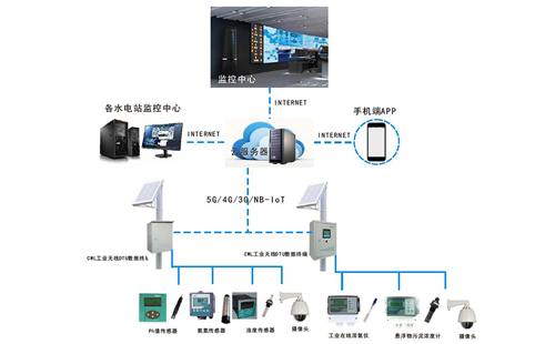
Monitor real-time water levels,rainfall,water quality,and equipment status
View on-site photos and videos
Support rapid decision-making through comprehensive hydrological insights.
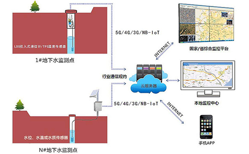
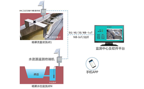
Applications include:Reservoir monitoring,small/medium river monitoring,channel flood warning,and flash flood disaster warning systems.
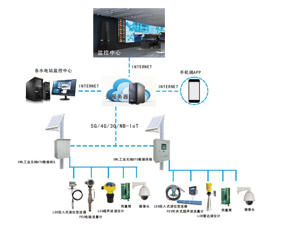
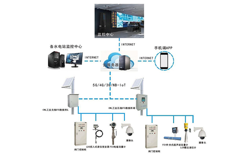
System Architecture:
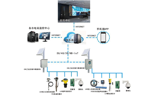
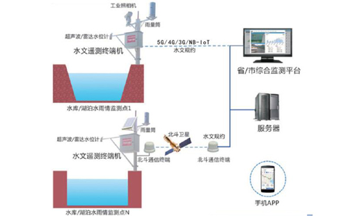
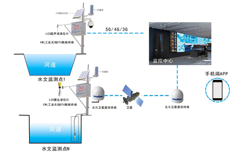
The open-channel water level/flow monitoring system consists of three core components:
Remote Data Acquisition Unit
Communication Network
Central Data Processing Software
(System structure illustrated in figure below)
Key Components:
Data Collection Devices:
CW-L Industrial Wireless DTU Data Terminal
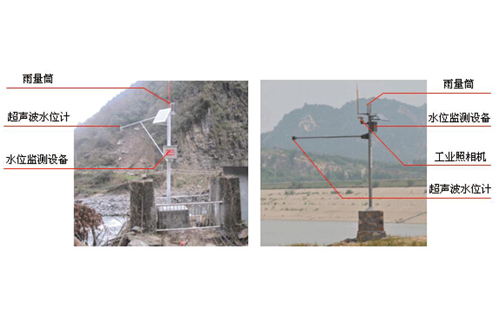
Rainfall Monitoring:Rain gauge cylinder
Water Level Monitoring:Submersible level sensor,radar level sensor,ultrasonic level sensor
Communication Infrastructure:
3G/4G/5G,fiber/ADSL,data radio,BeiDou satellite terminal
Central Data Processing Software:
Aggregates field data into a unified database
Enables real-time/historical data queries
Automatically generates hydrological reports
Key Features Highlight:
▸Multi-scenario adaptation–From reservoirs to mountain flood zones
▸Modular design–Expandable sensor integration(e.g.,water quality probes)
▸Redundant communication–Cellular+satellite+wired backup
▸Automated reporting–Regulatory-compliant hydrological analytics